
Chicago skyline
More than 1,000 custom buildings and objects cover downtown, with bridges, stadiums, marinas and trains.
Chicago, Illinois, USA Map
X-Plane 11
Follow Lake Michigan past downtown Chicago, the river bridges and the harbours lining the city’s shore.
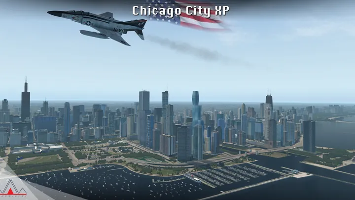
More than 1,000 custom buildings and objects cover downtown, with bridges, stadiums, marinas and trains.
Scenery extends from Highland Park to Schaumburg and Oak Lawn, with detailed terrain, buildings and multiple heliports.
Custom terrain and elevation data define the lakeshore and suburbs. A lighter texture pack is included.


Designed for X-Plane 11.
Remove earlier or overlapping scenery for the same location before installing. On Windows, run the supplied installer. On macOS or Linux, follow the manual installation guide included with the download.
Customer support has ended for this edition. No further updates will be released.
Chicago stretches along the western shore of Lake Michigan. The Chicago River reaches the lake just north of the Loop, passing between some of the city’s most recognisable buildings. Look west along the river and its bridges lead deep into downtown. Looking south along the shore brings Grant Park, the museum campus and the stadium into view in succession.
The city grew where a short overland connection linked the Great Lakes watershed with the rivers leading to the Mississippi. Canals, railways and lake shipping turned that crossing into a major inland port. The river branches at Wolf Point, once a centre of trade. Freight yards and industrial corridors still show how goods moved between the water and the rail network.
The lakefront developed along different lines. Parks, beaches and marinas occupy long stretches of the shoreline, while Navy Pier projects into the lake at the river mouth’s northern side. Offshore, there is enough distance to see how the towers cluster around the river and the Loop, with lower neighbourhoods extending for miles beyond them.


