← All products

YSWS · Western Sydney, Australia Map

Western Sydney International Airport

Microsoft Flight Simulator 2020 & 2024

Explore Western Sydney’s purpose-built terminal, from the metro and passenger concourse to the taxiways at Badgerys Creek.
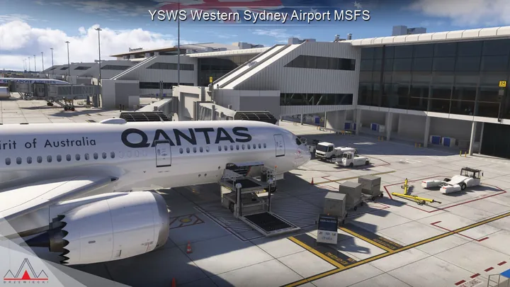
Qantas aircraft and service vehicles at terminal · Western Sydney International Airport

Scenery features

Western Sydney airfield

Custom terrain follows the runway profile. Physically based materials and dynamic lighting define the stands and taxiways.

Passenger terminal

Modelled interiors include working lifts, escalators and baggage belts, with animated passengers inside the building.

Rail and ramp activity

Metro trains, ground vehicles and moving jetways connect the landside and airside scenes, with parked aircraft on the apron.

Screenshots

Show 49 more screenshots
  • Low sun along pavement marking
  • Red holding-position sign painted on pavement
  • Terminal roof covered in solar panels
  • Terminal and parking layout from overhead
  • Runway and access roads among fields
  • Banking view over airport grounds
  • Runway and development from altitude
  • Taxiway alongside industrial buildings
  • Airport approach road from above
  • Terminal plan at sunset
  • Roofline and forecourt from above
  • Sunlight through terminal windows
  • Terminal seating beneath large windows
  • Entrance doors in glazed terminal
  • Gate seating overlooking apron
  • Control tower beside terminal glazing
  • Solar panels along passenger pier
  • Aircraft stands from terminal roof
  • Sunlight reflected in concourse glazing
  • Service vehicles below boarding gates
  • Marked aircraft parking position
  • Aircraft nose and pushback tug
  • Service platform beside aircraft
  • Airliner parked in strong sunlight
  • Terminal roof shading the apron
  • Yellow rescue vehicle beside service bay
  • Close view of metal truss
  • Cylindrical storage tanks
  • Pipework among storage tanks
  • Earthworks and surrounding roads
  • Orange approach-light fixtures
  • Mechanical equipment inside service enclosure
  • Service road looping beside taxiways
  • Taxiway intersection and holding markings
  • Escalators leading to railway platform
  • Covered station platform beside tracks
  • Metro train at platform
  • Inside a metro carriage
  • Divided approach road in low sunlight
  • Passenger aircraft at gates at dusk
  • Airliner and boarding bridges in evening light
  • Line of aircraft along passenger pier
  • Cars filling terminal parking rows
  • Singapore Airlines jet at terminal
  • Seating beneath timber terminal roof
  • Runway approach lighting at night
  • Apron and terminal under floodlights
  • Illuminated terminal complex from above
  • Qantas aircraft parked at evening gate

Where to buy

PC retailers

Browse the full store directory

Installation & support

Simulator compatibility

Compatible with Microsoft Flight Simulator 2020 and 2024, and with Drzewiecki Design, Orbx and Asobo scenery.

Installation

Use the installer or scenery manager supplied by your retailer. If the installer offers scenery options, run it again to change them.

About the airport

Western Sydney International (Nancy-Bird Walton) Airport (YSWS) occupies a greenfield site at Badgerys Creek and Luddenham, west of Sydney’s central business district. The Blue Mountains rise beyond the western suburbs. Its setting differs considerably from Kingsford Smith Airport on Botany Bay, where long-established neighbourhoods and the shoreline limit the room available for airport development.

A second gateway for Sydney

After decades of discussion about a second major airport for Sydney, the Australian Government confirmed Badgerys Creek as the site in 2014. Construction began in 2018. The first stage was planned around one 3.7-kilometre runway and an integrated domestic and international terminal, with land set aside for freight, transport links and future expansion.

The airport honours Nancy Bird Walton, a pioneering Australian aviator whose flying in rural New South Wales helped bring medical care to remote communities. This scenery depicts the airfield and terminal from the project designs. It includes the planned rail connection as well as the aircraft stands, showing how passengers were intended to move between the new airport and the wider city.

Open original